Viewing entries tagged
Dog Mountain

Dog Mountain - January 15, 2022

Dog Mountain - January 15, 2022

Dog Mountain is arguably the Columbia Gorge’s most popular hike. The spring balsamroot flower show on the mountain’s upper slope is in such demand that it is now a permitted event on weekends April 24 through June 13.

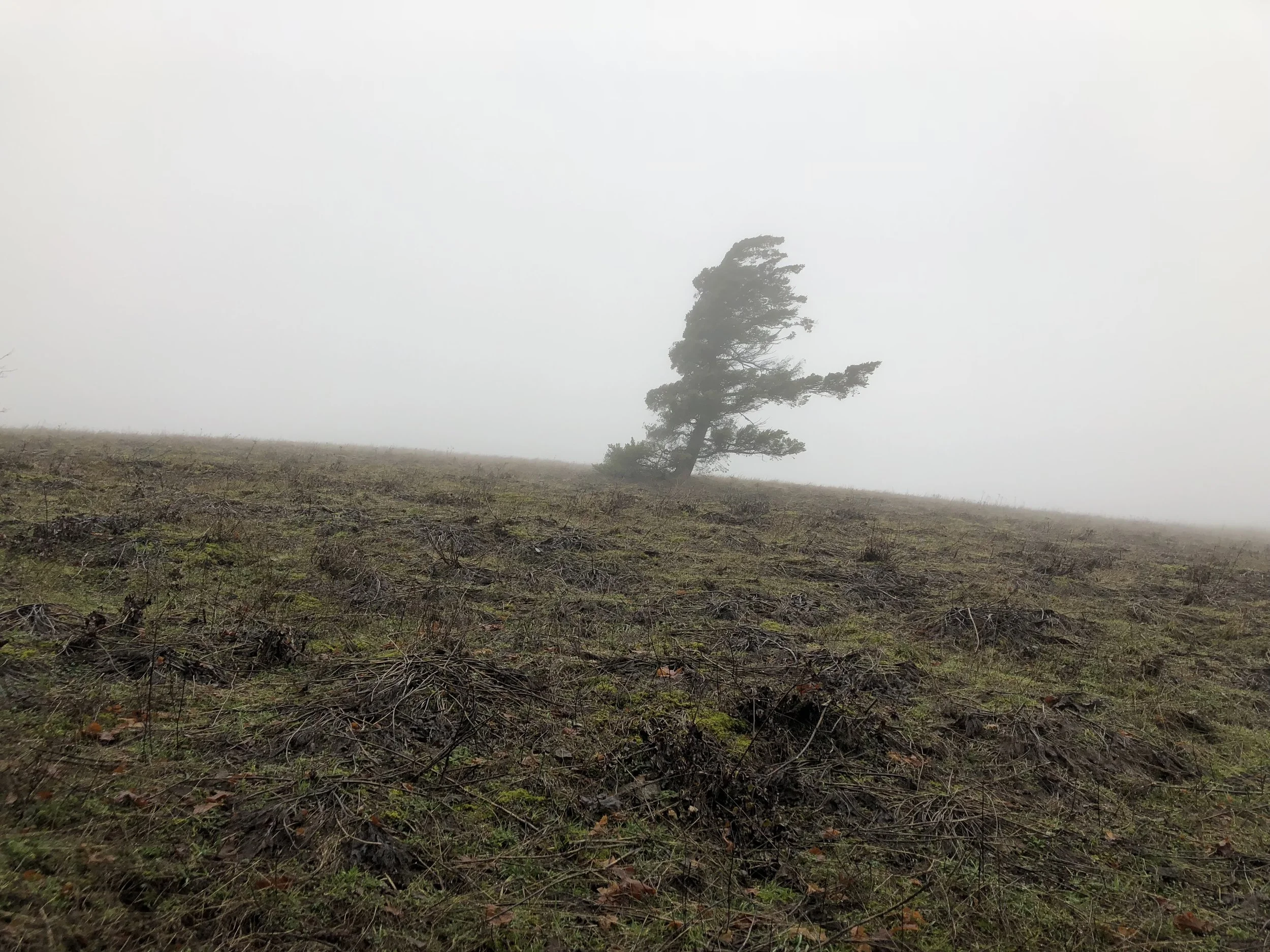
We went up on a cold January day with snow reaching down to the parking lot. Despite early cloud cover, we found sun on the summit. More importantly, we found adventure and solitude.

Click here for photos from the hike.

Sign with one mile to go until the Dog Mountain summit.

The Pentaquest Team standing on the Dog Mountain summit with Mount Hood and Mount Defiance in the background.

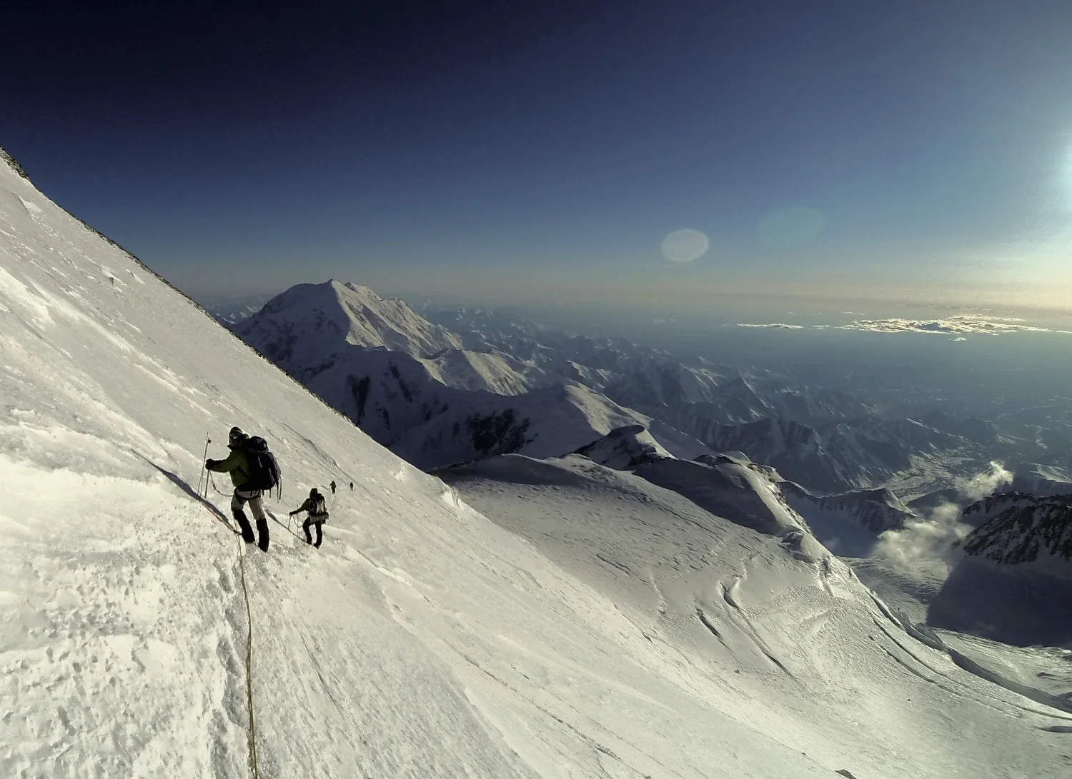
Climbers nearing the Dog Mountain summit.

Dog Mountain - January 9, 2021

Dog Mountain - January 9, 2021

The team hit the trail on Saturday, January 9 for the year’s first training hike up Dog Mountain after an emotionally challenging week that included an insurrection in Washington, D.C. and record daily COVID-19 deaths in the U.S. Although known for its impressive wildflowers in the spring and summer, winter on the Dog is equally rewarding. We were able to find solitude and adventure on a day with almost perfect January weather (no rain and only light wind).

The team heading back to the trailhead.

The team heading back to the trailhead.

More photos from the hike are available here.

Dog Mountain - August 25, 2018

Dog Mountain - August 25, 2018

You can’t go wrong on Dog Mountain (2,948 feet) in the Columbia Gorge on a cool, hazy Saturday in August. And if you can only find one friend to go with you? No problem.

Difficult vs. More Difficult (spoiler alert: it’s all difficult)

Difficult vs. More Difficult (spoiler alert: it’s all difficult)

Click here for more photos from the hike.

We left Portland early and hit the trail by 9 am. After going up the initial switchbacks, we opted for the “more difficult” path. This challenging option shaves off some mileage by going straight up the Dog.

Haze above the treeline.

Haze above the treeline.

The haze persisted above the treeline, blocking our view except for the trail and some balsamroot remnants left over from the spring floral show. Even Wind Mountain near the Columbia remained invisible. But then everything changed on the summit. As we started our descent, Mother Nature lifted the blanket and the river and mountains came into view.

The haze starts to lift! Wind Mountain is on the right.

The haze starts to lift! Wind Mountain is on the right.

We hurried back to the trailhead and were back on the road close to noon. On the way home, we stopped in Stevenson and discovered The Cabin Drive-Thru’s frozen custard.

Conditions look even better by the river.

Conditions look even better by the river.

Dog Mountain - February 4, 2018

Dog Mountain - February 4, 2018

On Sunday, February 4th, our group of three headed out to the Washington side of the Columbia Gorge for a quick pre-Super Bowl hike up Dog Mountain. To save time, we decided to go up and down the “more difficult” route – the steeper, shorter way to knock out the Dog’s 2,800 vertical feet of elevation gain.

Trail option between "difficult" and "more difficult."

Trail option between "difficult" and "more difficult."

For the first two miles in the woods, conditions were reasonable for early February. The trees captured the light rain, preventing most of the drops from reaching us. A stiff breeze could be heard in the distance and only occasionally reached down to the trail.

The lonely tree below the summit.

The lonely tree below the summit.

At the edge of the treeline, we entered a world of wind and rain. The final push to the summit was an exercise in discomfort management as a sustained 20-30 mph wind and sideways rain pummeled us. Upon reaching the top, we lingered only long enough to eat a snack and then powered back down to the parking lot.

Descending back to the parking lot.

Descending back to the parking lot.

Key lesson: always bring a full change of clothes. I brought fresh socks and shoes, but not pants. I think the money in my wallet is still damp as I write this.

Click here for more photos from the hike.

Dog Mountain - March 5, 2016

Dog Mountain - March 5, 2016

By Ryan Yambra (@Ryambra)

Dog Mountain is among the most popular hiking destinations in the Gorge. During springtime, the mountain boasts abundant wildflowers as well as multiple vistas offering expansive views of the Gorge. But make no mistake--with about 2,800 feet of elevation gain in less than three miles, Dog Mountain is a steep hike requiring some fitness.

Due to Dog Mountain’s (relatively) lower elevation, this hike is a great early season challenge. For this day, we expected the worst as the weather forecast hinted at wind and rain. But we encountered the opposite: unusually warm temperatures, moderate cloud cover, and zero rain. We didn’t even make it a mile before we chose to take off some of our layers.

Beginning at the Dog Mountain Trailhead, the path starts off steep. After .7 miles of climbing, freeway traffic sounds begin to fade as the trail reaches a junction in the forest. At this point, the trail splits in two directions: an older route marked ‘more difficult’ and a newer, ‘less difficult’ one. We were up for a challenge, so we took a left up the ‘more difficult’ trail. 

More Difficult, Less Difficult

The more challenging path leads deeper into the forest than the easier one, and there aren’t any viewpoints along the way. Instead it’s up, up, up with very few even grades. Our trekking poles kept us going at a brisk pace with few stops.

After about a mile of climbing, the two trails converge. This is where it gets tough. The trail ascends steeply another half mile, eventually breaking away from the cover of the forest. During springtime, the hillside flanking the trail explodes with golden meadows of balsamroot. In early March, they still haven’t quite bloomed. 

Once emerging from the trees, the trail begins to level out. From here, there’s no shortage of views. Facing south, hikers get a glimpse of the entire Oregon side of the gorge. And as the trail continues east, the Hood River Valley starts to emerge.

A major viewpoint sits about a half mile from here. The viewpoint, known as “Puppy Dog Lookout,” is the site of an old fire lookout that’s since been decommissioned. This point offers panoramic views to the south, east and west. 

From the lookout, the trail continues another half a mile to the summit. Before the summit, the trail meets another junction that can be used to make a loop hike. We took a left, heading west towards the top. This is where the trail gets rocky and requires some extra attention. As the trail curls around the mountainside, the summit comes into view. Finally, less than two hours after beginning the trailhead, we made it to the highest point.

On this particular day, members of another hiking party were eating their lunches and getting a little rest before descending. We watched them leave and enjoyed some solitude--a rare treat for such a popular destination. As we ate and got some rest, ourselves, we had a view of Mt. Defiance to the south.

After a while, it was time to head back down. The descent can be challenging in its own way, as the steep decline can be tough on the knees. Early on, the trail also becomes just barely exposed--on a busy day, passing hikers could make it a bit precarious. 

From the summit, there are a couple ways to descend. We chose to return from where we came. To make the descent more interesting, we headed down the ‘less difficult’ route at the first junction, which offers hikers another vista from a lower viewpoint. After soaking in the view, we continued down the forest path, back to the trailhead.

With or without wildflowers, Dog Mountain should be on every Gorge hiker’s short list. On this Saturday in March, the stars aligned, treating us to springtime conditions without the crowds to show for it.

Click here for more photos from the hike.