Viewing entries tagged
Columbia Gorge

Hamilton Mountain - January 22, 2022

Hamilton Mountain - January 22, 2022

The team hiked Hamilton Mountain in the Columbia Gorge on a perfect January day. Click here to view the photos.

Rodney Falls from the Hamilton Mountain trail.

Sun rays through the trees.

Viewpoint below the summit with the Columbia River in the distance.

Another vista below the summit.

Saddle between Little Hamilton and the main Hamilton Mountain.

Summit view with Table Mountain in the distance.

Snow while descending from the summit.

Dog Mountain - January 15, 2022

Dog Mountain - January 15, 2022

Dog Mountain is arguably the Columbia Gorge’s most popular hike. The spring balsamroot flower show on the mountain’s upper slope is in such demand that it is now a permitted event on weekends April 24 through June 13.

We went up on a cold January day with snow reaching down to the parking lot. Despite early cloud cover, we found sun on the summit. More importantly, we found adventure and solitude.

Click here for photos from the hike.

Sign with one mile to go until the Dog Mountain summit.

The Pentaquest Team standing on the Dog Mountain summit with Mount Hood and Mount Defiance in the background.

Climbers nearing the Dog Mountain summit.

Angel's Rest - January 1, 2022

Angel's Rest - January 1, 2022

Happy New Year! The team started off 2022 with an ice-cold hike up Angel’s Rest in the Columbia Gorge (Stats: 4.8 miles, 1,540 vertical feet). We hit the trail around 8 a.m. and reached the windy summit before 10.

Click here for more photos from the hike.

The Pentaquest Team at the Angel’s Rest trailhead.

The Pentaquest Team at the Angel’s Rest trailhead.

Icy trail below the Angel's Rest summit.

Icy trail close to the summit.

Sunny skies near the summit.

The team standing on a windy Angel’s Rest summit.

Mount Defiance - May 30, 2021

Mount Defiance - May 30, 2021

Mount Defiance is the ultimate Columbia Gorge training hike with 4,500 vertical feet in elevation gain over 12 miles. We hit the trail on Memorial Day weekend to get ready for an upcoming Mount St. Helens climb. Click here for photos from the hike.

Columbia Gorge view after crossing into the Mark O. Hatfield Wilderness.

Columbia Gorge view after crossing into the Mark O. Hatfield Wilderness.

Hardy Ridge - May 16, 2021

Hardy Ridge - May 16, 2021

Today (5/16) we hiked up Hardy Ridge in the Columbia Gorge under perfect conditions. Here’s a link to photos from the hike.

Wildflowers on Hardy Ridge with Hamilton Mountain in the foreground, and the Columbia River and Mount Hood in the distance.

Wildflowers on Hardy Ridge with Hamilton Mountain in the foreground, and the Columbia River and Mount Hood in the distance.

Table Mountain - April 17, 2021

Table Mountain - April 17, 2021

Table Mountain is an epic Columbia Gorge hike with over 17 miles and 3,400 vertical feet starting at Bonneville Dam. We hiked Table over 12 hours on April 17, 2021 with perfect conditions. From the summit, five volcanoes were on display (Hood, Jefferson, Adams, St. Helens, and Rainier).

View from Table Mountain’s summit with Mount Hood, Bonneville Dam, and the Columbia River.

View from Table Mountain’s summit with Mount Hood, Bonneville Dam, and the Columbia River.

Click here to view photos from the hike.

Dog Mountain - January 9, 2021

Dog Mountain - January 9, 2021

The team hit the trail on Saturday, January 9 for the year’s first training hike up Dog Mountain after an emotionally challenging week that included an insurrection in Washington, D.C. and record daily COVID-19 deaths in the U.S. Although known for its impressive wildflowers in the spring and summer, winter on the Dog is equally rewarding. We were able to find solitude and adventure on a day with almost perfect January weather (no rain and only light wind).

The team heading back to the trailhead.

The team heading back to the trailhead.

More photos from the hike are available here.

Dog Mountain - August 25, 2018

Dog Mountain - August 25, 2018

You can’t go wrong on Dog Mountain (2,948 feet) in the Columbia Gorge on a cool, hazy Saturday in August. And if you can only find one friend to go with you? No problem.

Difficult vs. More Difficult (spoiler alert: it’s all difficult)

Difficult vs. More Difficult (spoiler alert: it’s all difficult)

Click here for more photos from the hike.

We left Portland early and hit the trail by 9 am. After going up the initial switchbacks, we opted for the “more difficult” path. This challenging option shaves off some mileage by going straight up the Dog.

Haze above the treeline.

Haze above the treeline.

The haze persisted above the treeline, blocking our view except for the trail and some balsamroot remnants left over from the spring floral show. Even Wind Mountain near the Columbia remained invisible. But then everything changed on the summit. As we started our descent, Mother Nature lifted the blanket and the river and mountains came into view.

The haze starts to lift! Wind Mountain is on the right.

The haze starts to lift! Wind Mountain is on the right.

We hurried back to the trailhead and were back on the road close to noon. On the way home, we stopped in Stevenson and discovered The Cabin Drive-Thru’s frozen custard.

Conditions look even better by the river.

Conditions look even better by the river.

Mt. Defiance - May 27, 2018

Mt. Defiance - May 27, 2018

Mt. Defiance is many things - the Columbia Gorge's highest point, a great training hike for bigger peaks (with 4,500 feet in elevation gain), scenic, usually uncrowded, etc. Easy is not on the list. Following 2017's Eagle Creek Fire, the U.S. Forest Service closed Mt. Defiance and other trails affected by the fire until crews could clear debris and ensure trail safety.

Click here to view more photos from the hike.

Sign warning about hazards left by the Eagle Creek Fire.

Sign warning about hazards left by the Eagle Creek Fire.

On May 27, our group hiked Defiance soon after the trail's reopening. Thankfully the fire did not do too much damage to the trail. We passed through several patches clearly scorched by the fire on the way up the main route. But the summit area and entire Starvation Ridge Trail were unscathed.  

Evidence the Eagle Creek Fire passed through the Mt. Defiance trail.

Evidence the Eagle Creek Fire passed through the Mt. Defiance trail.

Conditions were ideal - the sky was mostly clear and the temperature remained in the 60s and 70s. After leaving the parking lot, we quickly reached the unrelenting switchbacks Defiance is known for. We kept up a steady pace, taking only a few brief breaks, and reached the top in four hours.

Mt. St. Helens, Mt. Rainier, and Mt. Adams (left to right).

Mt. St. Helens, Mt. Rainier, and Mt. Adams (left to right).

Following lunch and IPAs in the sun near the radio towers, we descended past Warren Lake and followed Starvation Ridge down to the parking lot.

Mt. Hood from the Mt. Defiance summit.

Mt. Hood from the Mt. Defiance summit.

Key takeaway: Mt. Defiance is back in business. The Eagle Creek Fire left a mark, but Defiance is ready for the summer. As an added bonus, the volcano views are now even better on the main trail where the fire cleared out the brush.

Descending Starvation Ridge.

Descending Starvation Ridge.

Coyote Wall-Labyrinth Loop - April 29, 2018

Coyote Wall is the perfect hike for a nice day during wildflower season when you don't want to deal with the crowds on Dog Mountain. On April 29th I joined two friends for a quick hike around the Coyote Wall-Labyrinth Loop. We hit the trail early and made it to Hood River in time for lunch at Solstice Pizza.

Click here to view more pictures from the hike.

Hardy Ridge - March 11, 2018

Hardy Ridge - March 11, 2018

Hardy Ridge is one of the better hikes on the Washington side of the Columbia River and often overlooked by Dog Mountain devotees on a quest for yellow wildflowers. On the warmest day of 2018 (so far), our team of five hiked up Hardy in search of snow, adventure, and the perfect vista to sip an IPA.

Our team going up the switchbacks below the ridge.

Our team going up the switchbacks below the ridge.

The sky above the parking area was blue and clear as we started around 9am. The first mile through the trees brought occasional views of the Columbia to the south and the upper reaches of the ridge above us. We traveled at a brisk pace and quickly reached the start of switchbacks and snow.

Looking east towards Table Mountain to the left in the foreground, the Columbia River, and Dog Mountain in the center background.

Looking east towards Table Mountain to the left in the foreground, the Columbia River, and Dog Mountain in the center background.

The final mile to the summit was a beautiful slog with perfect weather as we post-holed our way in deep snow up the ridge. Mt. Hood watched over us from the Oregon side of the river, and eventually we caught glimpses of Mt. Adams and the top of Mt. Rainier to the north.

The team hiking up through the snow and nearing the summit with Mt. Hood in the distance.

The team hiking up through the snow and nearing the summit with Mt. Hood in the distance.

After enjoying a snack in a flat area out of the wind below the high point, we descended back down the trail and retraced our steps back to the car following the same path.

Descending the ridge and heading back to the trailhead.

Descending the ridge and heading back to the trailhead.

Overall, the day was 10: near flawless conditions, great company, and few other hikers. We didn’t encounter any other groups until after we reached the top. The snow slowed us down and presented a few navigation challenges, but added an element of adventure to the day. If you’re thinking of hitting the Gorge soon, consider Hardy Ridge.

Click here for more pictures from the hike.

Dog Mountain - February 4, 2018

Dog Mountain - February 4, 2018

On Sunday, February 4th, our group of three headed out to the Washington side of the Columbia Gorge for a quick pre-Super Bowl hike up Dog Mountain. To save time, we decided to go up and down the “more difficult” route – the steeper, shorter way to knock out the Dog’s 2,800 vertical feet of elevation gain.

Trail option between "difficult" and "more difficult."

Trail option between "difficult" and "more difficult."

For the first two miles in the woods, conditions were reasonable for early February. The trees captured the light rain, preventing most of the drops from reaching us. A stiff breeze could be heard in the distance and only occasionally reached down to the trail.

The lonely tree below the summit.

The lonely tree below the summit.

At the edge of the treeline, we entered a world of wind and rain. The final push to the summit was an exercise in discomfort management as a sustained 20-30 mph wind and sideways rain pummeled us. Upon reaching the top, we lingered only long enough to eat a snack and then powered back down to the parking lot.

Descending back to the parking lot.

Descending back to the parking lot.

Key lesson: always bring a full change of clothes. I brought fresh socks and shoes, but not pants. I think the money in my wallet is still damp as I write this.

Click here for more photos from the hike.

Table Mountain - January 14, 2018

Table Mountain - January 14, 2018

We started the 2018 hiking season on January 14th with Table Mountain on the Washington side of the Columbia Gorge near Bonneville Dam. With the closure last year of the usual trailhead at Bonneville Hot Springs, our team of four hikers took a longer approach starting at the Bonneville Trailhead near the dam. At the end of the day, we hiked close to 16 miles with 4,320 in vertical feet (compared to eight miles and 3,350 feet on the old route).

The conditions for January were spectacular as we started down the trail – partly cloudy skies, a light breeze, and a few rays of sun. After a half mile, we joined the Pacific Crest Trail and walked in the footsteps of thru-hikers from the Mexican border traveling north. The path passed through areas logged in recent years and by several small bodies of water – including Gillette Lake.

Gillette Lake from the Pacific Crest Trail.

Gillette Lake from the Pacific Crest Trail.

After several hours we passed by the junction to the old trail and eventually reached the base of the Heartbreak Ridge Trail to the summit. From here the fun/pain kicked into high gear and we gained a significant amount of elevation over a short distance. The wind also started to pick up and the temperature dropped.

Sign marking the Heartbreak Ridge Trail.

Sign marking the Heartbreak Ridge Trail.

At the saddle below the talus field scramble, a sustained wind howled just out of reach above our heads. We also entered into a thick cloudbank, eliminating our chance of seeing any volcanoes from the summit.

Our team on the summit.

Our team on the summit.

Above the rocks, we continued onward to the summit sign, took the requisite selfie, and then found a calm harbor out of the wind to enjoy an IPA. For the descent, we looped to the west side of the mountain and followed the trail along a steep cliff face before going back into the woods and rejoining the PCT.

View from the descent down the west side of the loop.

View from the descent down the west side of the loop.

Several hours later we were back at the parking lot and on our way as the sun began to set behind the mountains on the Oregon side of the river. We ended up spending about eight hours on the trail. Key takeaways: the first few miles of the longer approach to Table are significantly more scenic than the old route from the hot springs; 16 miles is a long way to go for the first hike of the year; and January hiking in the Gorge is always worth doing over watching NFL playoff games (unless it’s the Seahawks). We decided to go hiking, despite missing an afternoon of excellent playoff football. In the car ride home, we listened to the final minutes of the Minnesota Vikings-New Orleans Saints game on the radio. Something about hearing the play-by-play of the final minutes – rather than watching it at home – was even more exciting than seeing it on TV.

Click here for more photos from the hike.

Coyote Wall - April 1, 2017

Coyote Wall - April 1, 2017

After the wettest February and near-wettest March on record, we seized the opportunity to hit the trail when the forecast called for decent conditions. Coyote Wall - located east of Hood River on the Washington side of the Columbia River (and, more importantly, east of the crest of the Cascades to reduce the chance of encountering rain) - was our destination.

Hiking up the Labyrinth Loop overlooking the Columbia River.

Hiking up the Labyrinth Loop overlooking the Columbia River.

After parking at the recently upgraded trailhead area, we hiked along the base of the wall on an old road until we reached the start of the Labyrinth Loop. We took the loop, heading upward on the bucolic trail for several miles past waterfalls, a cave, and purple wildflowers. Eventually we took a fork that ended at a perfect lunch spot at the edge of the wall. During our descent, we encountered mountain bikers slogging upward before blitzing down the hill.

View from the edge of Coyote Wall.

View from the edge of Coyote Wall.

Overall it was a great day and a reminder that spring is coming soon.

Click here for more photos from the hike.

Hamilton Mountain - January 28, 2017

Hamilton Mountain - January 28, 2017

The first official Pentaquest hike of 2017 didn't go exactly as planned, but it still ended up being a fun day in the snow. After Portland was caught in the icy maw of Winter Storm Jupiter and several weeks of snow and ice brought travel in the Columbia Gorge to a halt, it was important to get out of town and hit the trail during a brief weather window. We originally planned to go up Hardy Ridge, but a road closure forced us to call an audible and shift to nearby Hamilton Mountain. The road to the trailhead was also closed, but the walk in from the parking area at Beacon Rock State Park only added an additional ten minutes.

Snow covered the route from the start, making it necessary to use microspikes to gain traction on the trail. Less than a quarter mile in we climbed over a downed tree that had likely fallen during one of the storms. While passing Hardy Falls, Rodney Falls, and the Pool of Winds, we noticed a considerable amount of damage to a fence along the trail. We kept going another mile and made a decision to turn around near the base of the switchbacks below Hamilton Mountain due to the depth of the snow and an issue with one of the traction devices.

Overall it was great to get in a snow hike see the Gorge in its winter brilliance. The Washington Trails Association and other trail crews have their work cut out for them in the coming months. Maybe we'll pitch in and join one of the volunteers teams to help out.

Click here for photos from the hike.

Trail damage near the Pool of Winds.

Trail damage near the Pool of Winds.

Angel's Rest - December 31, 2016

Angel's Rest - December 31, 2016

On New Year's Eve we trekked out to the Gorge and hiked up Angel's Rest. This is the fifth year in a row for the Pentaquest either starting or ending with this hike. We've encountered everything from dangerously slick ice, brutal cold, extreme winds, and other inclement trail conditions since the tradition started. But not on this day. Although the temperature hovered around freezing and visibility was limited, the wind was almost nonexistent and most of the group had poles and traction devices to navigate through the ice patches.

Rather than write up a detailed trip report, here's a haiku:

No view? No problem.

We closed down 2016.

A great group of eight.

Here's us on top of Angel's Rest. You can almost see Mt. Adams if you stare at the backdrop long enough.

Here's us on top of Angel's Rest. You can almost see Mt. Adams if you stare at the backdrop long enough.

The trail is one of the best places to reflect on the past year and think about what lies ahead. 2016 was a consequential year for many reasons. Speaking for myself, I can't think of a year with more contrast between the biggest win (birth of a child), and the worst loss (disastrous outcome of the November election). Regardless of what else is going on in the world, I gain strength spending time with great people on the trail.

Hardy Ridge - May 21, 2016

Hardy Ridge - May 21, 2016

By Ryan Yambra (@Ryambra)

Beacon Rock State Park is one of the most popular destinations in the Columbia River Gorge. With landmarks ranging from Hamilton Mountain to Beacon Rock, the 5,100-acre natural area has something for everyone.

But fewer people make the trek up Hardy Ridge. Tucked away at the Equestrian Trailhead, the route up Hardy Ridge gives hikers big views, spring wildflowers, and more than 2,000 feet of elevation gain without the crowds to show for it.

This particular Saturday in May was a soaker with heavy rain and low clouds. And while the views were less than spectacular, that didn't stop us from hitting the trail. 

This hike begins by heading north on the Equestrian Trail. After a slow, winding climb of about a mile, the wide path meets a junction with the West Hardy Ridge Trail. To make a loop, we ignored the western path and continued along the Equestrian Trail another half mile until reaching the East Hardy Ridge Trail.

Once hitting the East Hardy Ridge Trail, which resembles a dirt road, we continued our gradual ascent. Eventually, the trail meets a junction with a connector marked ‘foot traffic only.’ As the light drizzle turned into a shower, we took the connector trail towards the top of the ridge. 

After about a half mile, this well-established path meets a four-way junction. Here, you can head up towards the Hardy Ridge summit or descend back into the trees.

Normally during late spring, a trip up to the summit gives hikers amazing views with sights of nearby Hamilton and Table mountains. On a clear day, Mount Adams is also visible. Sadly, the weather was too poor to enjoy the views up top. We chose to have lunch at the junction and head back down.

To make it back, we descended under the trees on the west trail along the western side of the ridge.

After a gentle downhill trek, the path spit us back out onto the Equestrian Trail. From there, we hiked slowly back down to our cars.

Hardy Ridge has plenty to offer hikers without the crowds of other nearby destinations. On the day, our total mileage was a bit under eight miles with the trail just to ourselves. Rain or shine, Hardy Ridge should be a destination for any hiker looking to try something new.

Click here for more photos from the hike.

Table Mountain - March 12, 2016

Table Mountain - March 12, 2016

By Dan Douthit (@dtonedouthit)

Looming over the western end of the Columbia Gorge is the aptly named Table Mountain, offering a challenging 3,200 vertical feet of elevation gain, varied terrain, and a guaranteed boost towards getting conditioned for even higher peaks. I've hiked Table many times before, usually on bluebird spring or summer days. On a clear day the view at the top is second to none in the Gorge, with the potential for seeing five volcanoes. On March 12, 2016, the conditions were far from ideal, but the experience was no less epic.

Our group rendezvoused at the Bonneville Hot Springs Resort around 8:30am. After paying for a $5 parking pass (redeemable for credit in the lodge after the hike), we hit the trail. The sky was overcast and dry, but the ground remained damp from earlier rain. Less than five minutes in - still within sight of the parking lot - I dunked my boot into a well-camouflaged mud hole. Fortunately my Vasque-brand boot performed like a boss and the mud slurry didn't creep into my socks.

The first few miles were pleasant as the trail snaked through the forest and gradually gained altitude. We passed by several spurs - one leading down a powerline road; the other toward Aldrich Butte. Past the two-mile mark we reached the junction with the Pacific Crest Trail. On this day we didn't encounter any thru-hikers, but we did see the skeleton of a teepee/lean-to-like structure likely used by PCTers.

We took the PCT for about another mile before reaching the true base of Table and the crux of the day's work. From this point, a spur - formerly known as the "Heartbreak Ridge" Loop (not after the Clint Eastwood movie about the Grenada invasion) - rockets up through the forest. Whether out of laziness or a moral aversion to switchbacks, the designers of this stretch decided to retain the natural steepness of the slope in their trail design. The end result is one of the steeper sustained segments I'm aware of in the Gorge.

We kept a steady pace and began our ascent up Heartbreak, pausing several times for a quick breather. The sky remained overcast in all directions, but we began to catch views of the river and the surrounding mountains below the cloud cover. We eventually reached Sacagawea Rock and a flat section of the trail offering stunning views to the east and west.

Then, back in the woods, we pushed onward until we reached a talus field of large stones covering the hillside. The established trail evaporates through this field, forcing hikers to choose their own path between a series of cairns with wooden markers. Stepping slowly to avoid a rolled ankle or smashed knee, we proceeded to the top of the rocks and returned to the forest for the final push to the summit.

With less than a quarter miles to go, we reached another junction and turned toward the top. Upon exiting the woods, we came to the flat "table" part of the mountain. No longer protected by trees, we started to experience strong winds buffeting the summit plateau and surrounding ridges. We quickly traversed across the top of the plateau to reach a sharp drop-off overlooking the Columbia. Upon reaching this point - and just as I was about to eat a fake meat roast beef sandwich washed down by a Fort George IPA - an angry wind howled in from the west. And then a shotgun blast of hail came down followed by blowing snow and diminished visibility.

We made a group decision to eat fast (and refrain from drinking the IPAs), and make tracks down the mountain without delay. Rather than walk across the top of Table and complete the Heartbreak loop, we retraced our steps and went straight down the talus field. The full loop down the west side of Table affords incredible views of the Gorge, but on this day there was nothing to see. We also wanted to avoid additional exposure. The prospect of climbing down a mile of wet rocks above a precipitous drop didn't sound appealing to any of us.

As we descended, the snow began to stick and oscillate in size - from near sleet to large, Charlie Brown-style flakes. Once back in the forest below the rocks, the air temperature warmed to above freezing and we enjoyed a steady rain for most of the rest of the hike. Our journey back to the parking lot was muddier than earlier in the day, but uneventful. In a few places the trail seemed more like a streambed than a hiking path as gravity pulled the afternoon's precipitation toward the Columbia. Upon reaching Bonneville Hot Springs, we used our parking passes for credit in the hotel coffee shop and then headed back to Portland.

Overall - despite the wind, rain, and snow - we won the day. If you wait for a sunny day in March, you may never go hiking anywhere in Cascadia. Equipped with Gore-Tex and gloves, we weathered the inclement conditions with only minimal discomfort. My key lesson learned for future trips is to use more caution when stepping near running water on the trail. My muddy boot dunk 100 yards from the car could have been a major game-changer.

Click here for more photos from the hike.

Dog Mountain - March 5, 2016

Dog Mountain - March 5, 2016

By Ryan Yambra (@Ryambra)

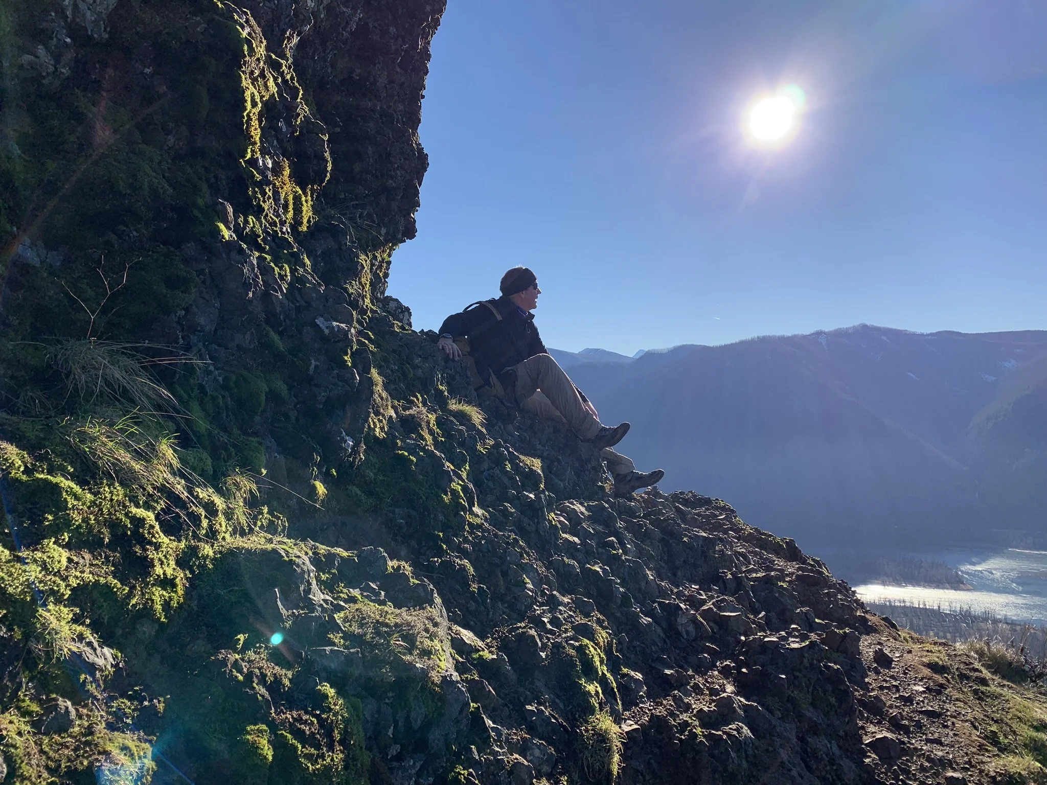
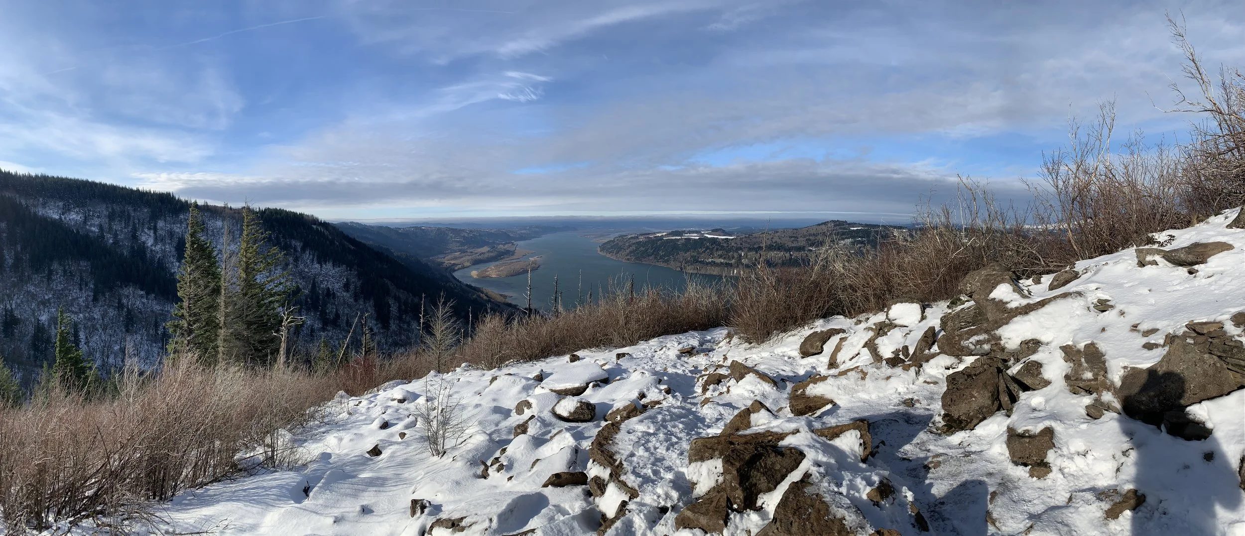
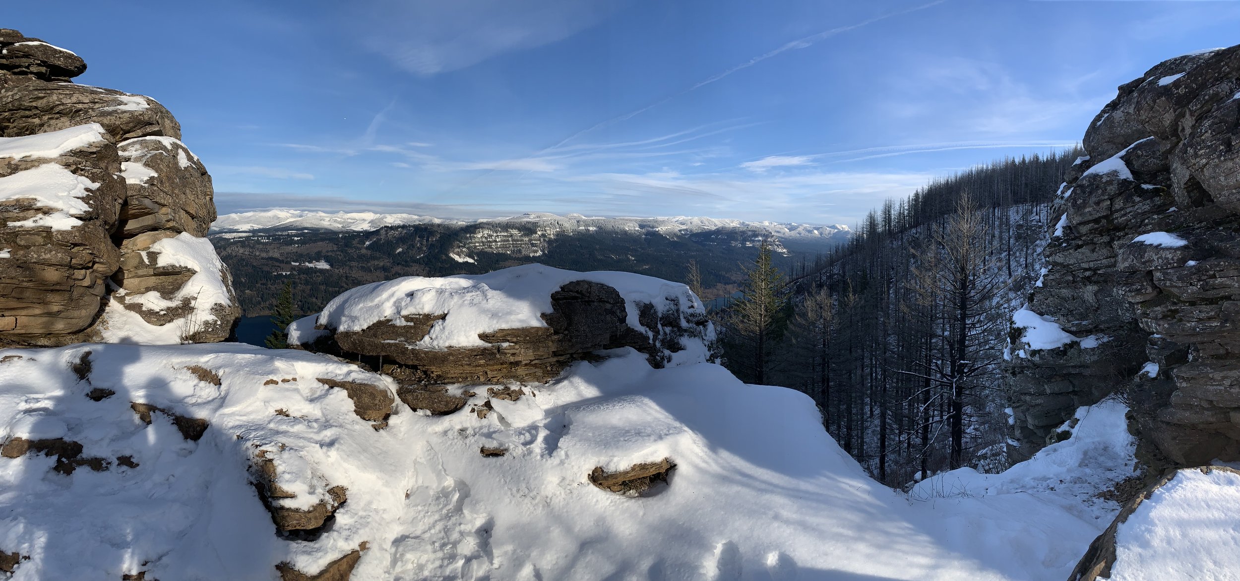
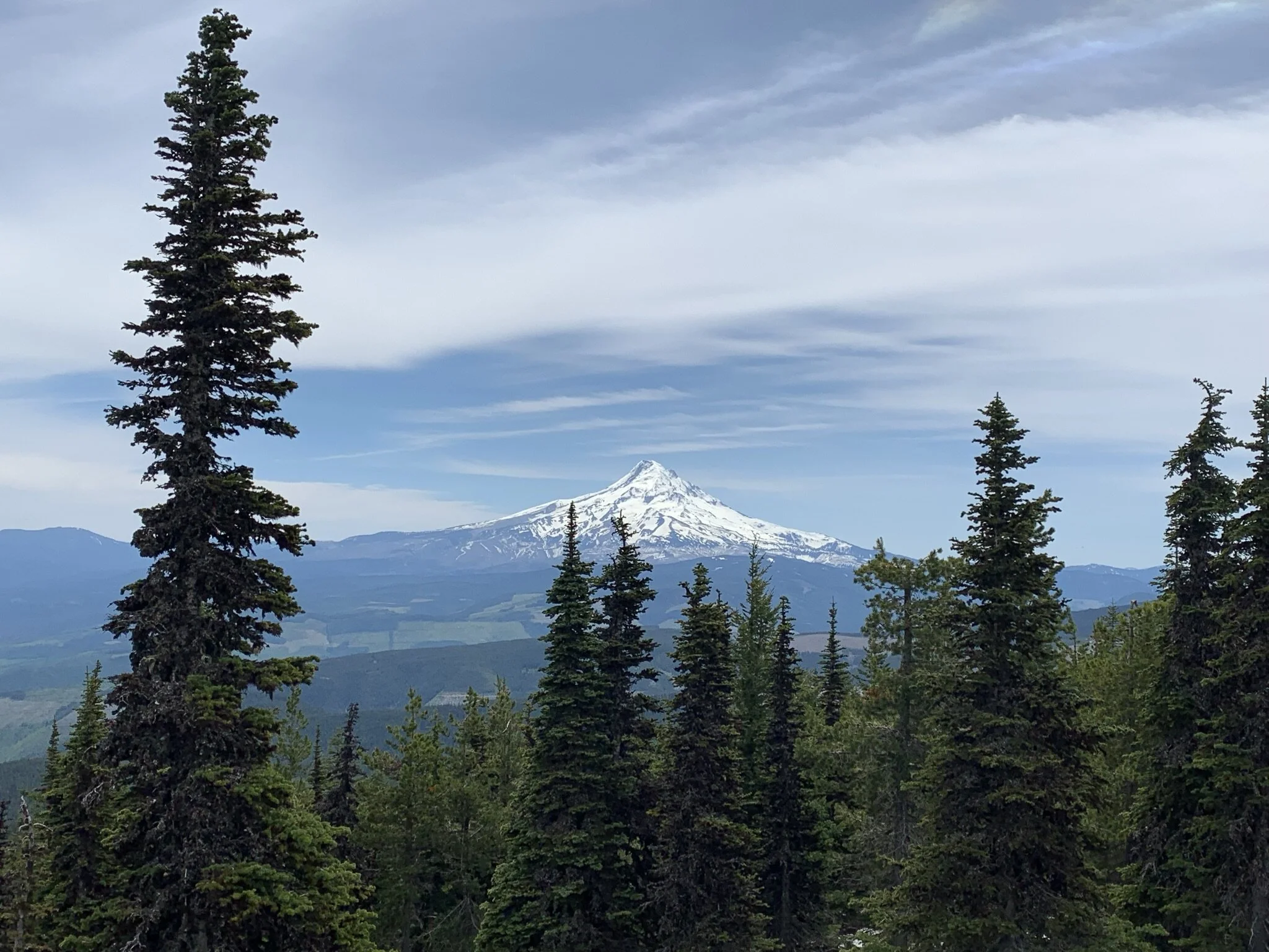
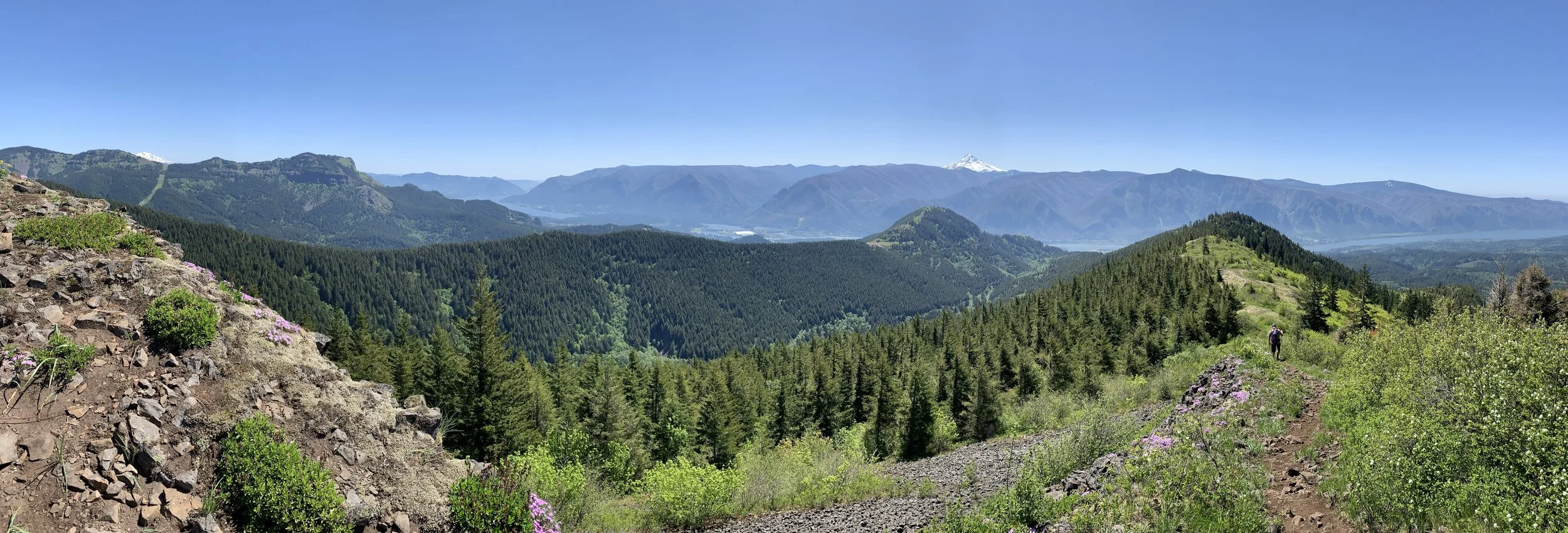
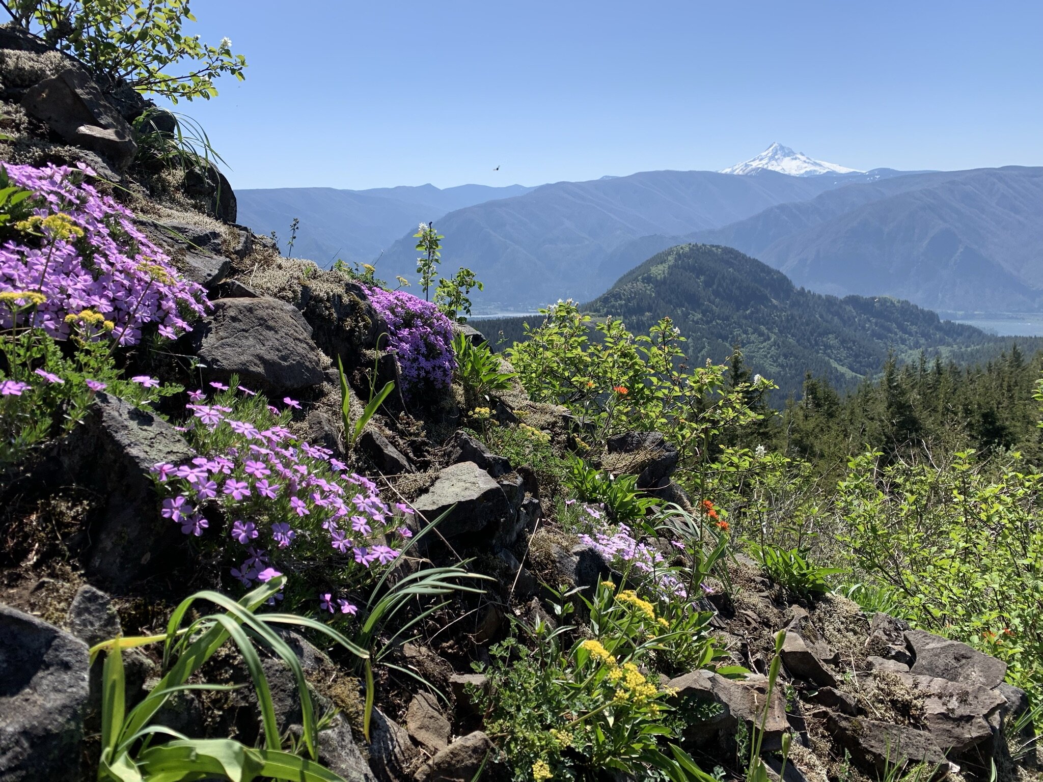
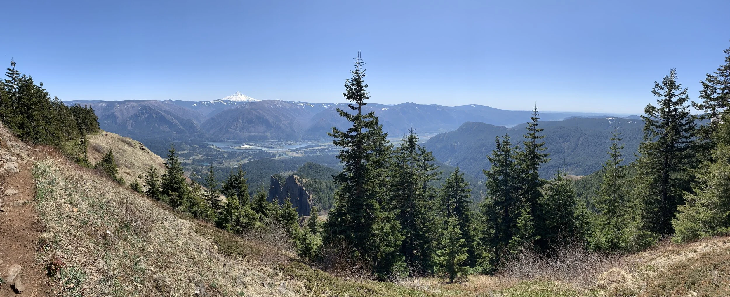
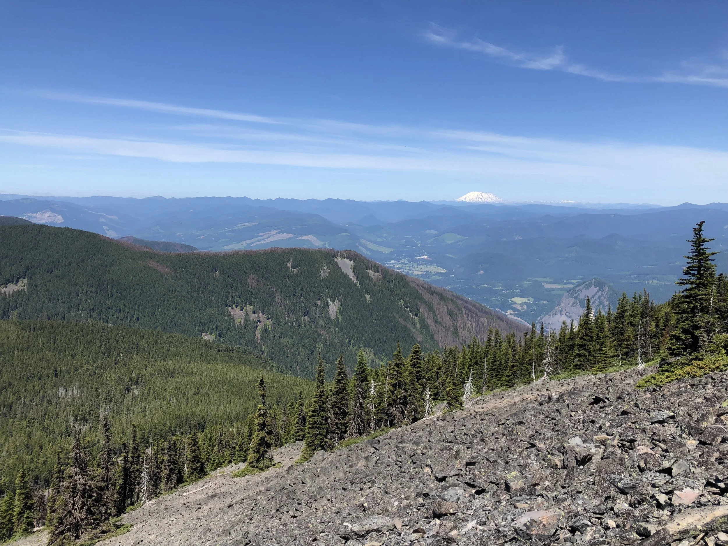
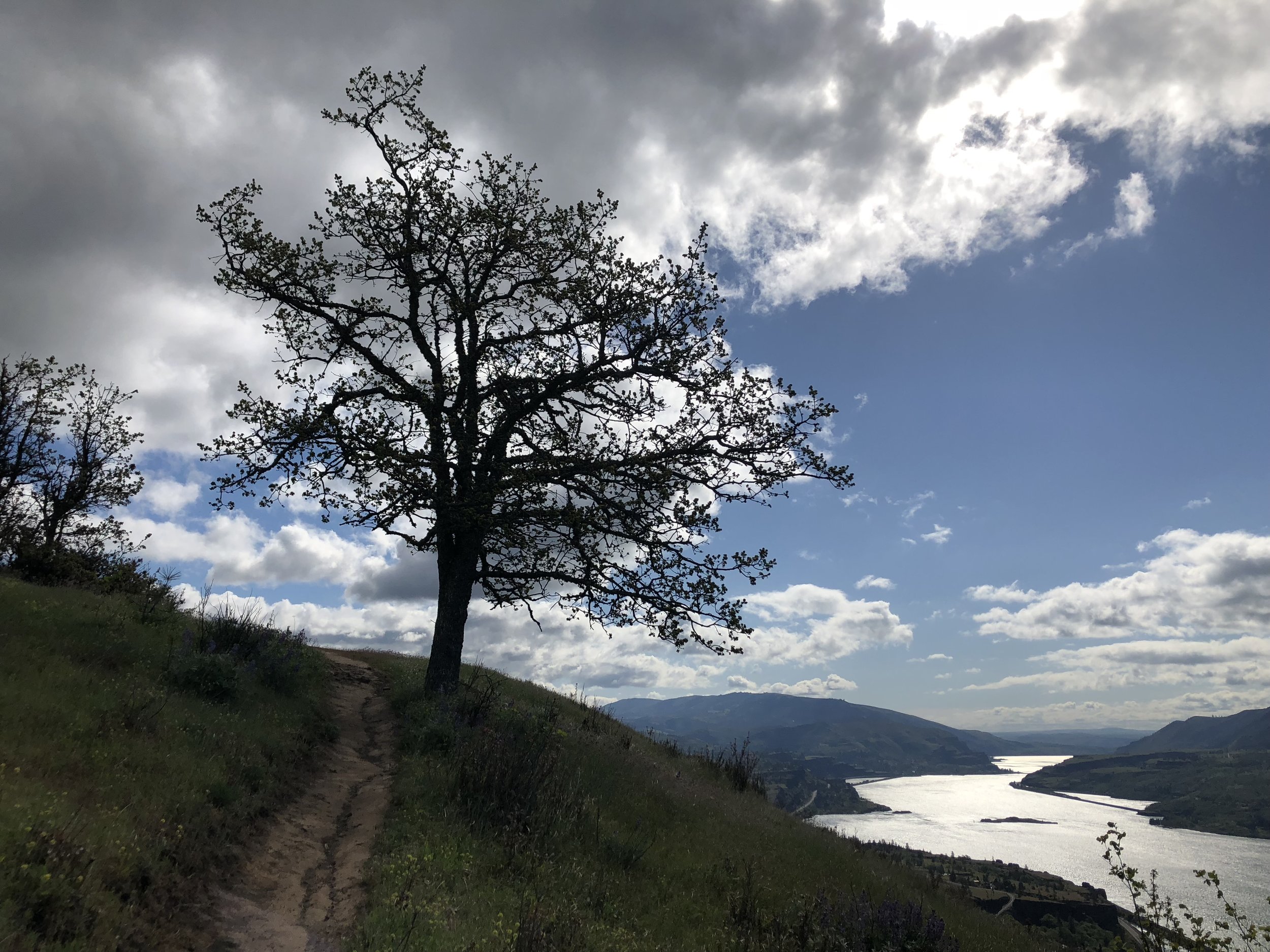
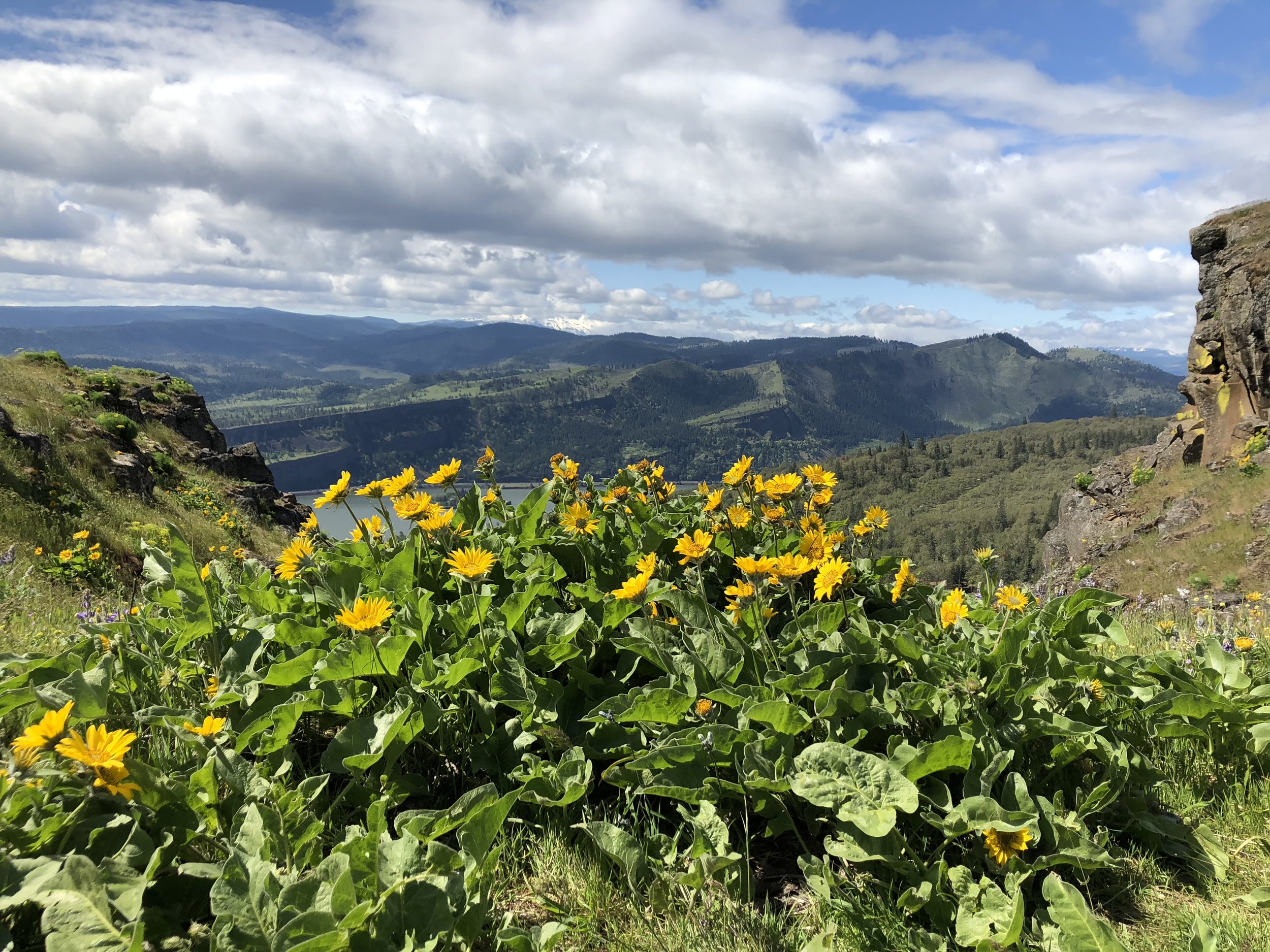
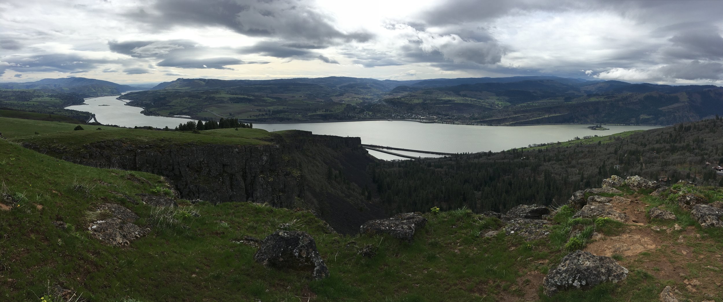
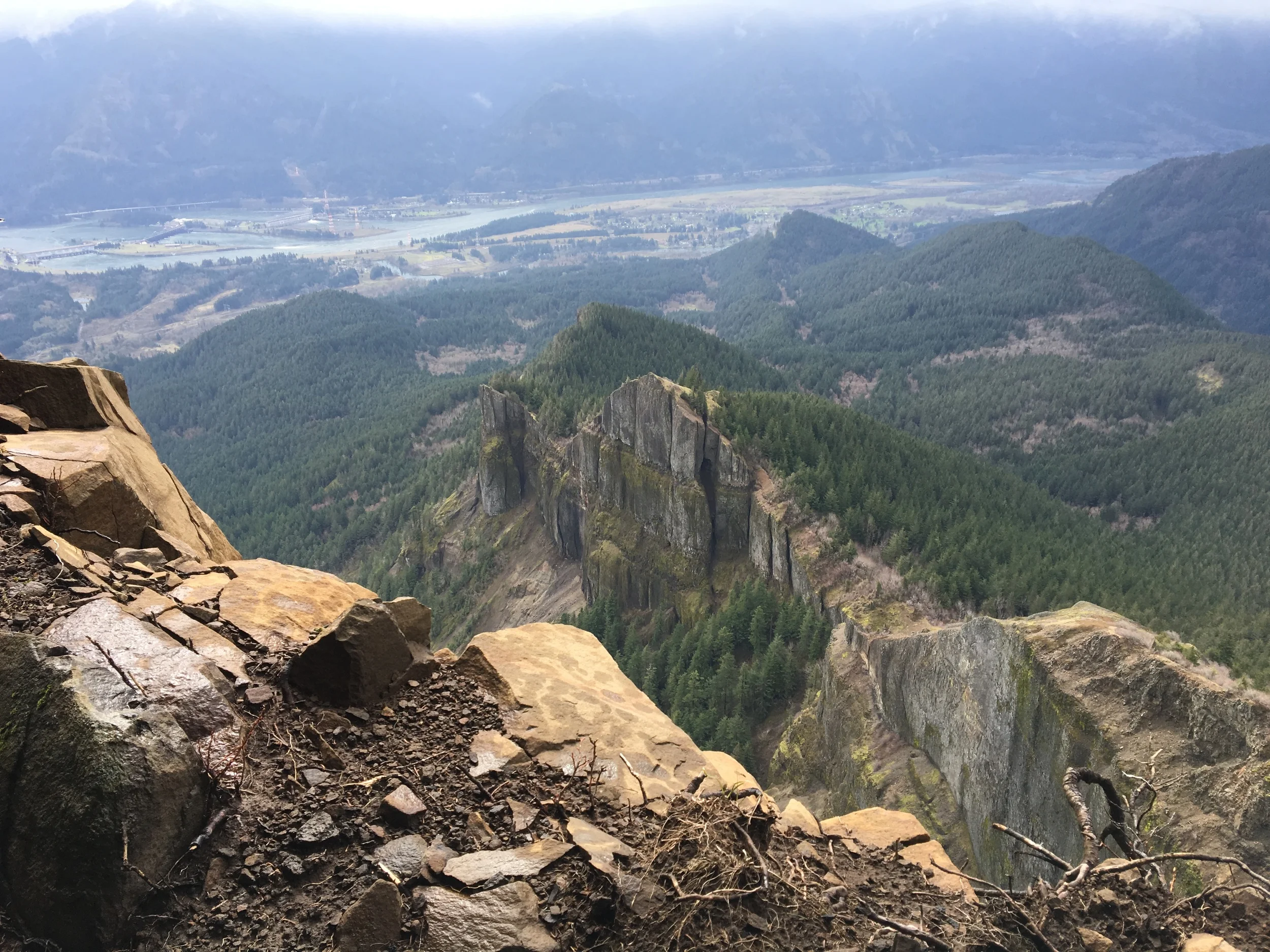
Dog Mountain is among the most popular hiking destinations in the Gorge. During springtime, the mountain boasts abundant wildflowers as well as multiple vistas offering expansive views of the Gorge. But make no mistake--with about 2,800 feet of elevation gain in less than three miles, Dog Mountain is a steep hike requiring some fitness.

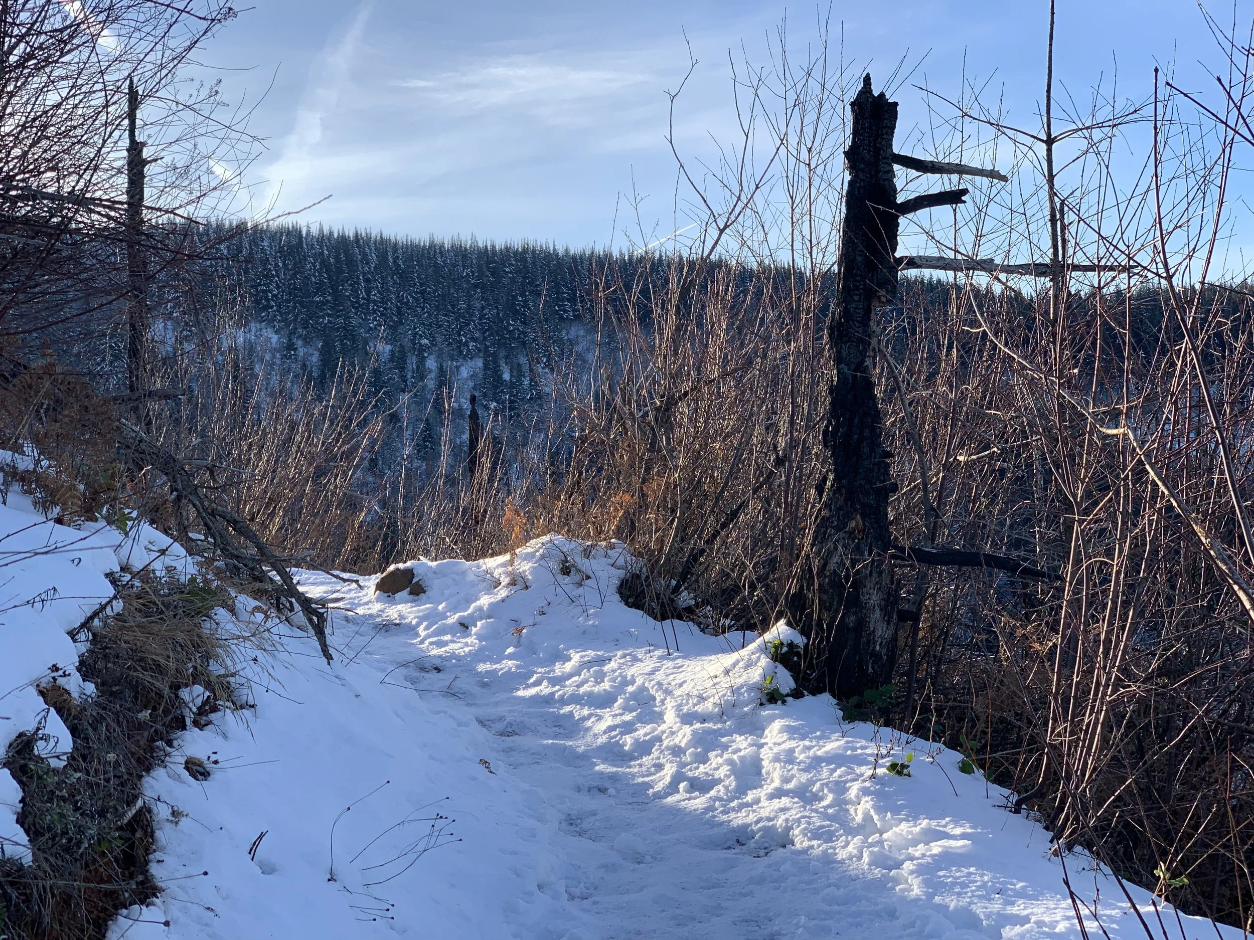
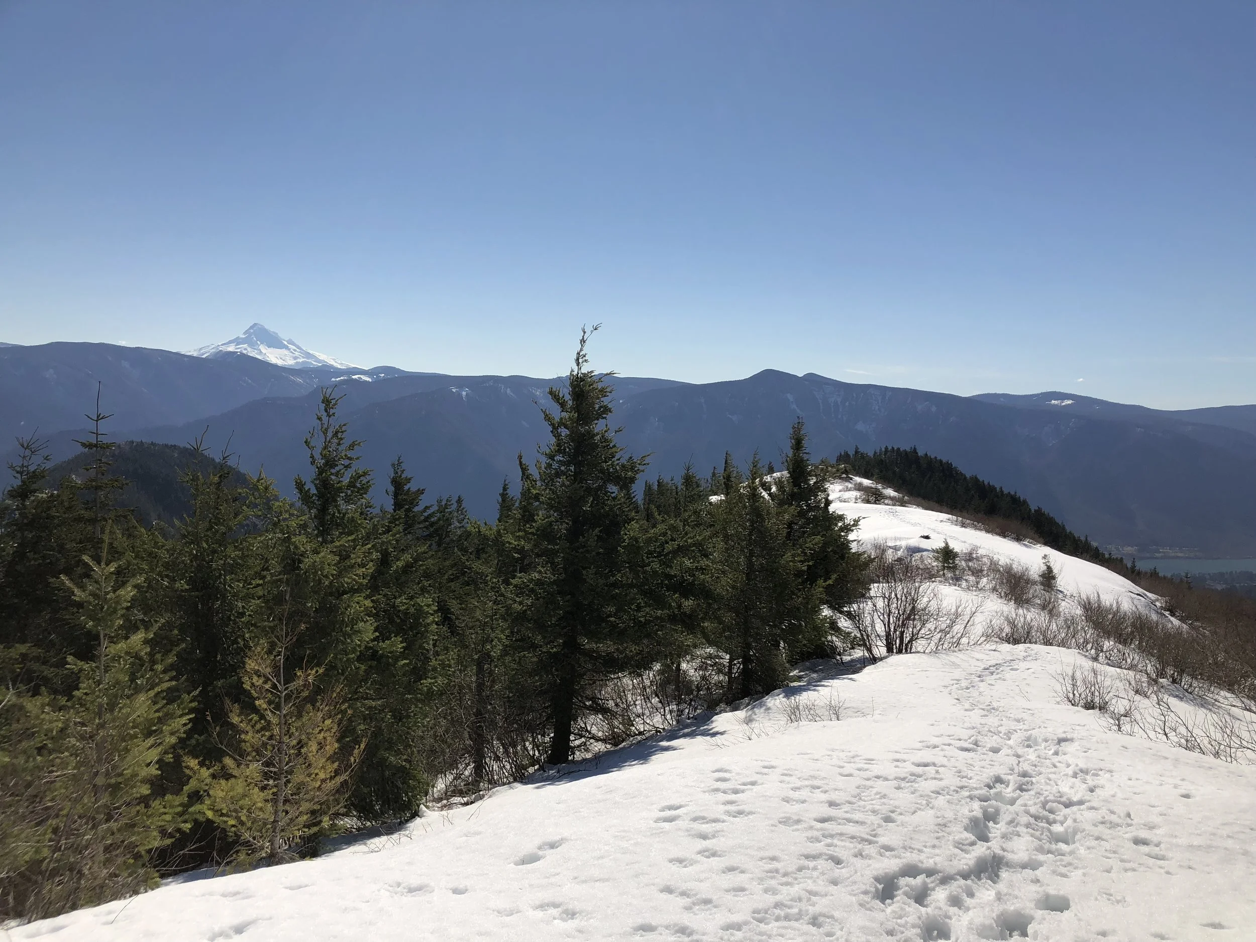
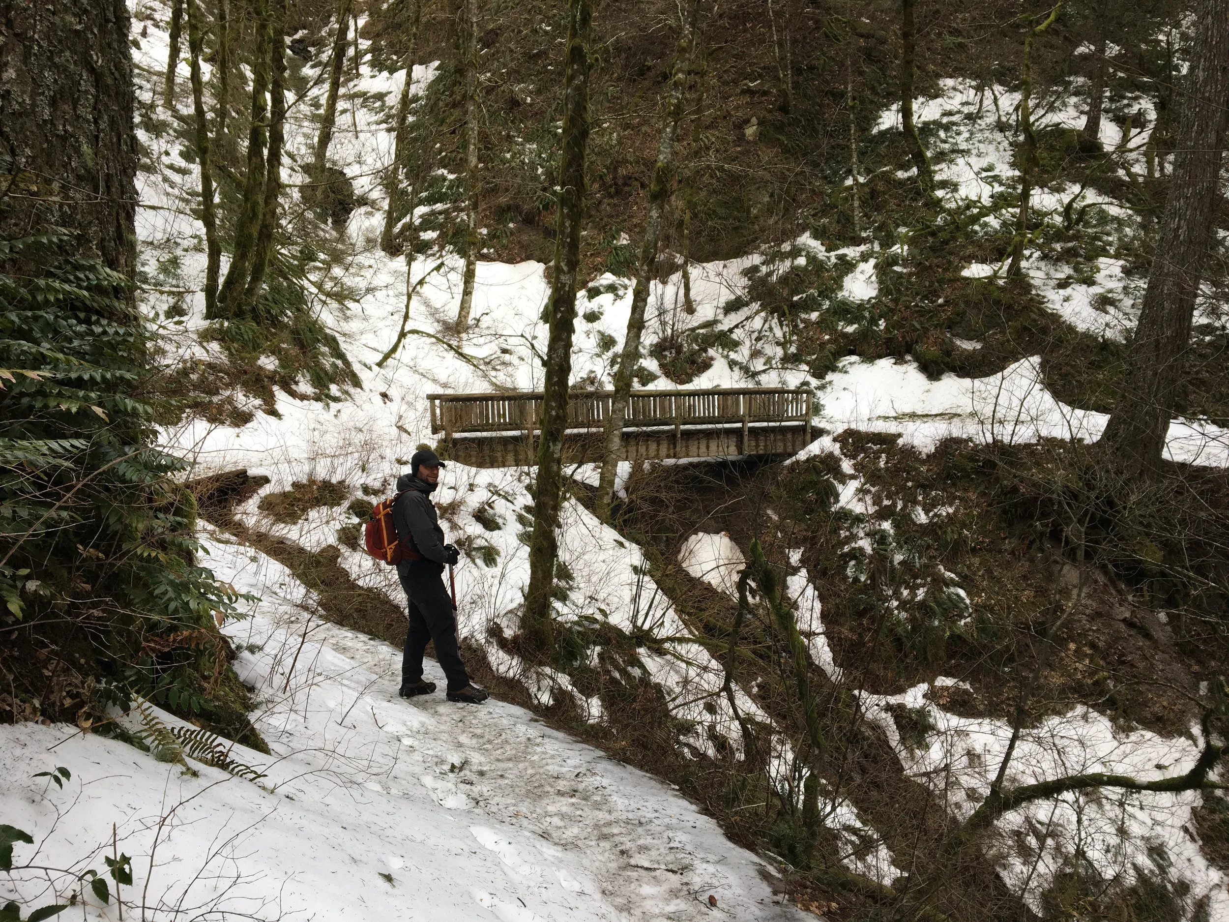
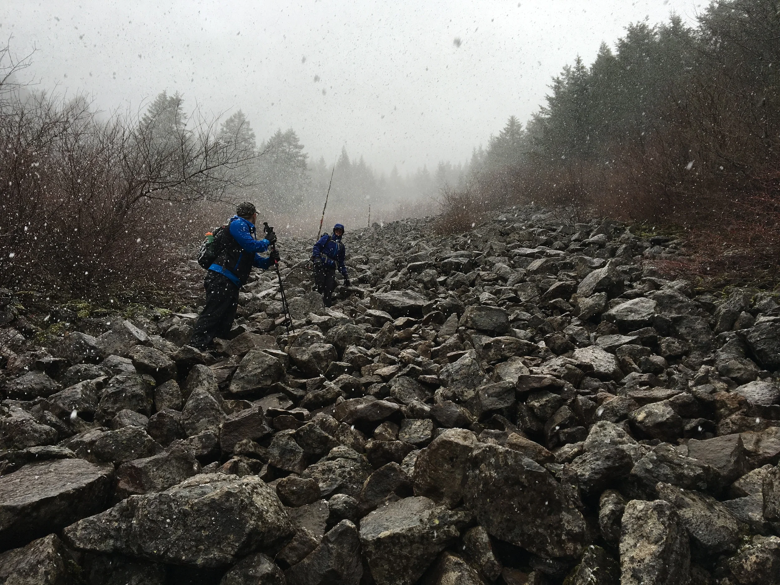
Due to Dog Mountain’s (relatively) lower elevation, this hike is a great early season challenge. For this day, we expected the worst as the weather forecast hinted at wind and rain. But we encountered the opposite: unusually warm temperatures, moderate cloud cover, and zero rain. We didn’t even make it a mile before we chose to take off some of our layers.

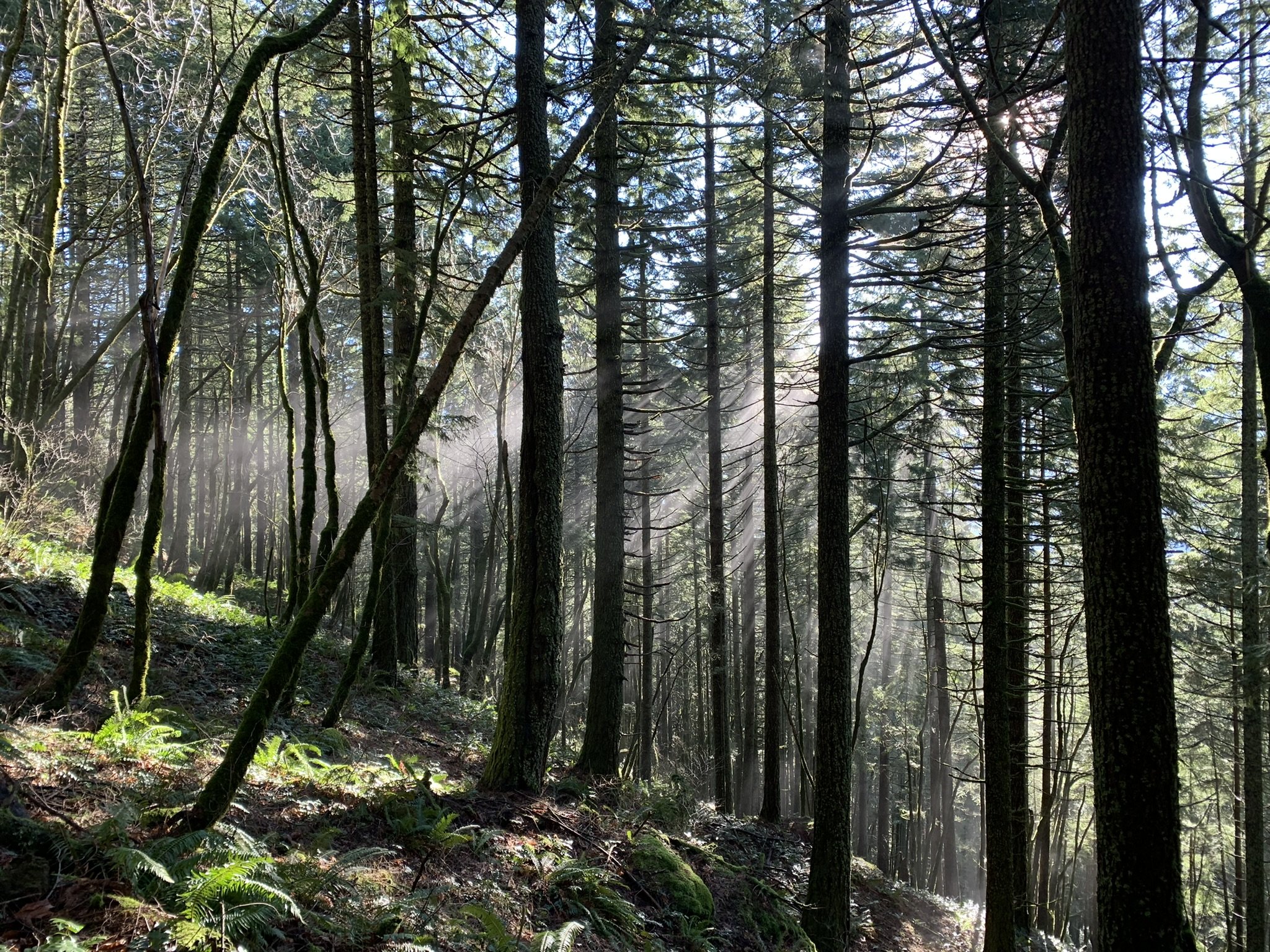
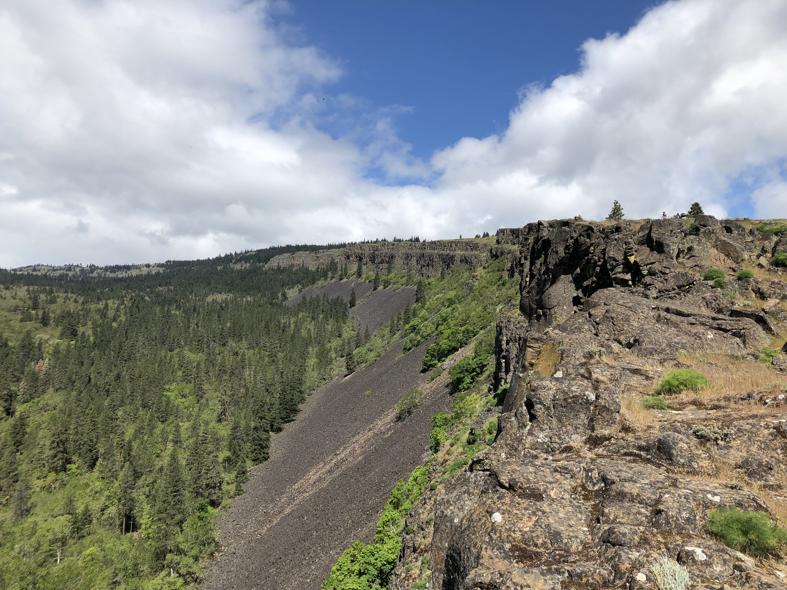
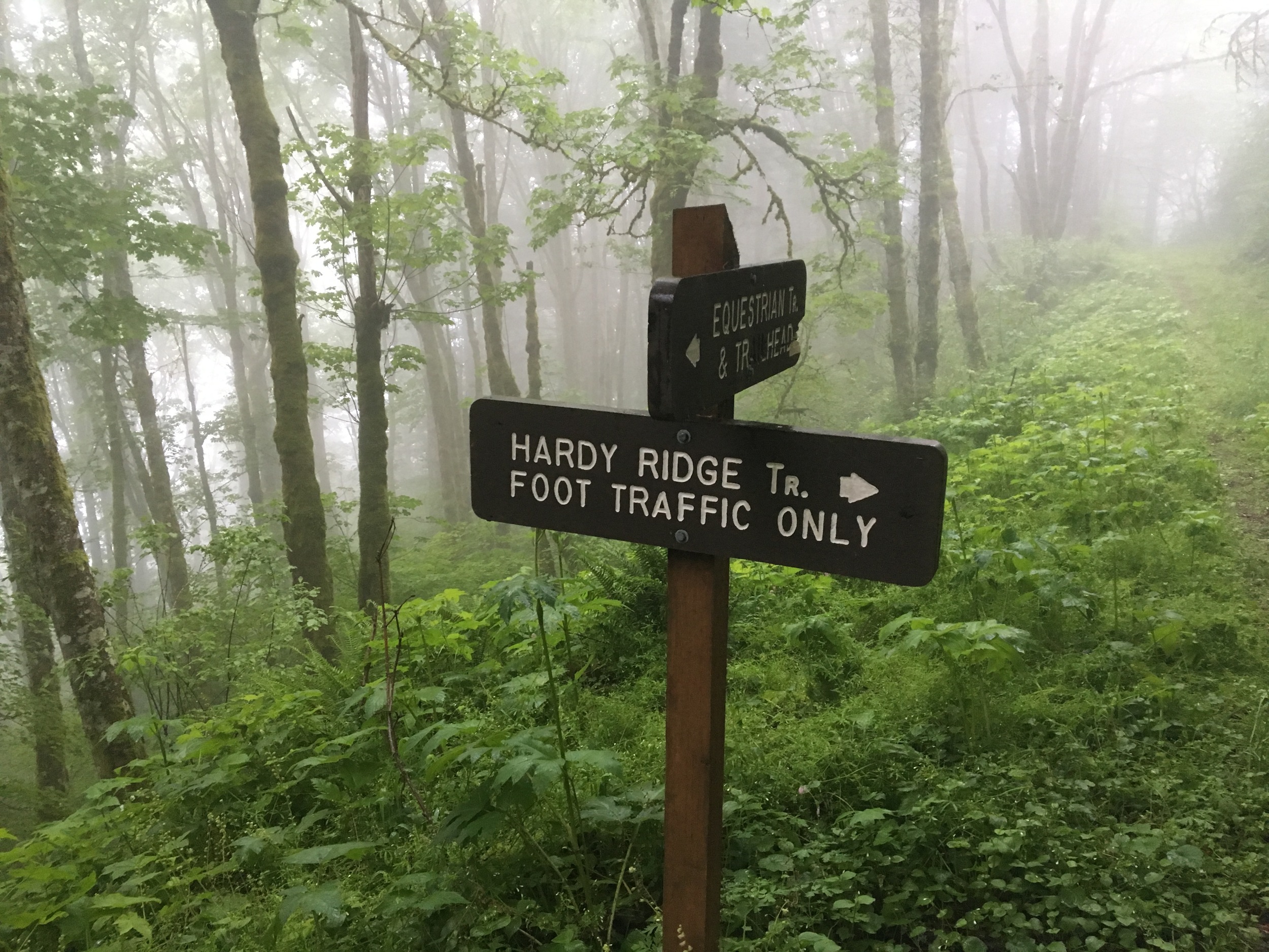
Beginning at the Dog Mountain Trailhead, the path starts off steep. After .7 miles of climbing, freeway traffic sounds begin to fade as the trail reaches a junction in the forest. At this point, the trail splits in two directions: an older route marked ‘more difficult’ and a newer, ‘less difficult’ one. We were up for a challenge, so we took a left up the ‘more difficult’ trail. 

More Difficult, Less Difficult

The more challenging path leads deeper into the forest than the easier one, and there aren’t any viewpoints along the way. Instead it’s up, up, up with very few even grades. Our trekking poles kept us going at a brisk pace with few stops.

After about a mile of climbing, the two trails converge. This is where it gets tough. The trail ascends steeply another half mile, eventually breaking away from the cover of the forest. During springtime, the hillside flanking the trail explodes with golden meadows of balsamroot. In early March, they still haven’t quite bloomed. 

Once emerging from the trees, the trail begins to level out. From here, there’s no shortage of views. Facing south, hikers get a glimpse of the entire Oregon side of the gorge. And as the trail continues east, the Hood River Valley starts to emerge.

A major viewpoint sits about a half mile from here. The viewpoint, known as “Puppy Dog Lookout,” is the site of an old fire lookout that’s since been decommissioned. This point offers panoramic views to the south, east and west. 

From the lookout, the trail continues another half a mile to the summit. Before the summit, the trail meets another junction that can be used to make a loop hike. We took a left, heading west towards the top. This is where the trail gets rocky and requires some extra attention. As the trail curls around the mountainside, the summit comes into view. Finally, less than two hours after beginning the trailhead, we made it to the highest point.

On this particular day, members of another hiking party were eating their lunches and getting a little rest before descending. We watched them leave and enjoyed some solitude--a rare treat for such a popular destination. As we ate and got some rest, ourselves, we had a view of Mt. Defiance to the south.

After a while, it was time to head back down. The descent can be challenging in its own way, as the steep decline can be tough on the knees. Early on, the trail also becomes just barely exposed--on a busy day, passing hikers could make it a bit precarious. 

From the summit, there are a couple ways to descend. We chose to return from where we came. To make the descent more interesting, we headed down the ‘less difficult’ route at the first junction, which offers hikers another vista from a lower viewpoint. After soaking in the view, we continued down the forest path, back to the trailhead.

With or without wildflowers, Dog Mountain should be on every Gorge hiker’s short list. On this Saturday in March, the stars aligned, treating us to springtime conditions without the crowds to show for it.

Click here for more photos from the hike.